Understanding BS and FS in Surveying
In the realm of surveying, precision is paramount. Whether you're constructing a building, planning infrastructure, or delineating property boundaries, the accuracy of measurements can make or break a project. To achieve this precision, surveyors rely on various techniques and tools, among which Backsight (BS) and Foresight (FS) are fundamental concepts.
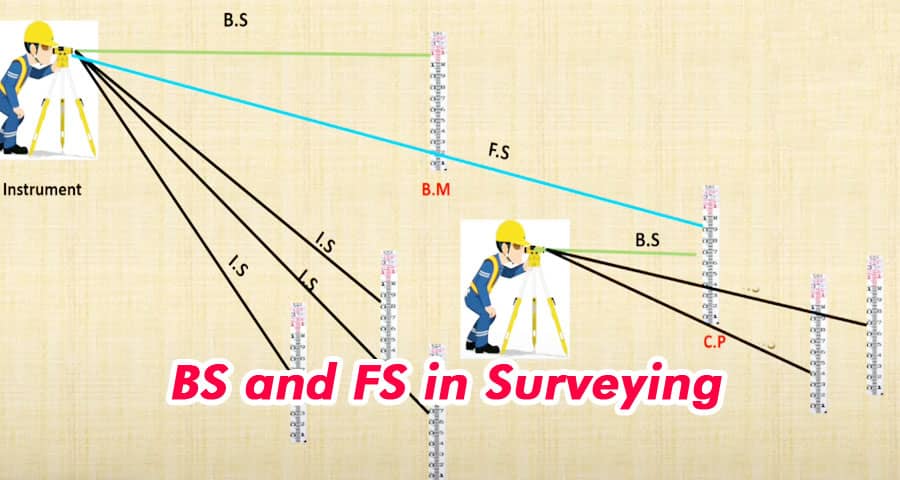
What are BS and FS?
Backsight (BS) refers to the process of sighting a previously established point of known elevation, typically a benchmark or a previously surveyed point. This serves as a reference for subsequent measurements. Essentially, it's the starting point from which all other measurements are made.
Foresight (FS), on the other hand, involves sighting a point where the elevation is to be determined. This could be the next point in a survey line or any other feature relevant to the project. The Foresight (FS) reading, when combined with the known elevation of the Backsight (BS), allows surveyors to calculate the elevation of the new point.
Importance of BS and FS in Surveying
The significance of BS and FS in surveying cannot be overstated. These measurements form the basis of leveling, a crucial aspect of surveying that ensures accuracy in vertical measurements. By establishing a reference point (BS) and then determining the elevation of subsequent points (FS), surveyors can create precise elevation profiles and contour maps essential for various engineering and construction projects.
Procedure for Using BS and FS
The process of using BS and FS in surveying follows a systematic approach:
- Establish the Backsight (BS): The surveyor begins by locating and sighting a benchmark or a previously surveyed point with a known elevation. This establishes the Backsight (BS).
- Take the Foresight (FS): Once the BS is established, the surveyor sights the point whose elevation needs to be determined. This is the Foresight (FS).
- Record Measurements: Measurements from the leveling instrument are recorded for both the BS and FS readings. These readings typically include the horizontal distance, vertical angle, and sometimes the slope distance.
- Calculate Elevation: Using the recorded measurements and the known elevation of the BS, the elevation of the FS point is calculated using trigonometric principles or leveling formulas.
- Verify and Adjust: After calculating the elevation, surveyors often verify the accuracy of their measurements through redundant checks or by comparing with other nearby points. Any necessary adjustments are made to ensure precision.
Applications of BS and FS
The use of BS and FS extends across various fields and applications within surveying:
- Construction: Ensuring precise grading and leveling of building sites.
- Engineering: Creating accurate topographic maps and profiles for infrastructure projects.
- Land Surveying: Establishing property boundaries and conducting cadastral surveys.
- Geomatics: Mapping land features and monitoring changes over time.
For more information, please watch the following video tutorial
Source: Billing Engineer Civil
Conclusion
In summary, Backsight (BS) and Foresight (FS) are foundational concepts in surveying, facilitating accurate vertical measurements essential for a wide range of projects. By understanding and effectively employing these principles, surveyors can ensure the integrity and reliability of their survey data, laying the groundwork for successful engineering and construction endeavors.