Brief Note on Contour Interval
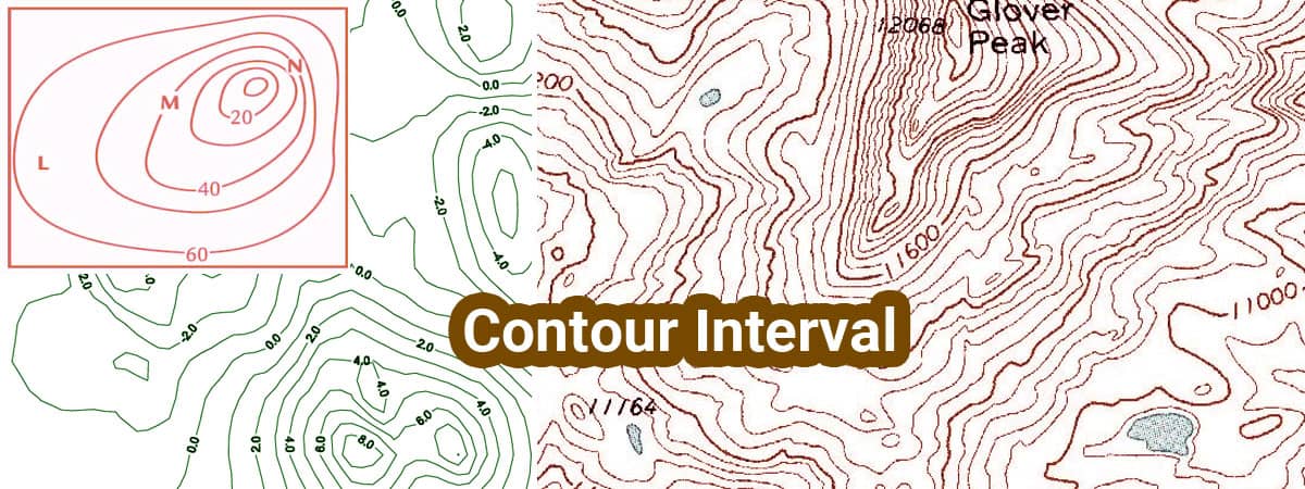
What Is Contour Interval?
It is the difference in elevation between two consecutive contour lines. For a relief map , the contour interval is usually constant.
Factor affecting contour interval
Contour interval depends upon the subsequent factor.
The Scale of The Map
Contour interval is inverse proportion to the size of the map. If the size is little then the contour interval should be large and vice-versa.
Nature of the bottom
The general topography of the world decides the contour interval. For a flat area, the contour interval should be small. For sloping or undulating ground the contour interval is chosen should be large.
Consideration in making the selection of the right contour interval
Before preparing a relief map , the contour interval required is set . Considering the subsequent factors on which contour interval depends
- Nature of the bottom surface
- The size of the Map
- The aim and extent of the survey
- Time and expense required
The following contour intervals may be adopted for various purpose.
- Small scale maps or rough country - 5m to 25 m
- Large scale maps pr flat country - 0.5 m
- Location survey - 2 to 3 m
- Building sites - 0.3 to 0.5 m
- Reservoir and town planning work - 0.5 to 1 m
- Detailed design of works - 0.5 m