Types and Differences of the Compass Surveying
Introduction to Compass Surveying
Compass surveying is one of the most fundamental methods in the field of geospatial science, primarily used to determine the relative position of objects on the earth's surface. This method employs a magnetic compass to measure the directions of survey lines and a chain or tape to measure distances. Compass surveying is especially useful in areas where high precision is not required, or in rough terrains where other methods are impractical.
Fundamentals of Compass Surveying
The primary instrument used in compass surveying is the prismatic compass or the surveyor's compass, both of which are designed to measure bearings or angles from the magnetic north.
Bearings and Types
Bearings are measured in degrees from the north in a clockwise direction and are used to describe the direction of a survey line. The types of bearings used in compass surveying include:
- Whole Circle Bearing (WCB): Ranges from 0° to 360°.
- Reduced Bearing (RB): Expressed as N/S followed by E/W and always measured from the north or south towards the east or west (ranges from 0° to 90°).
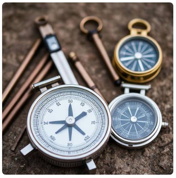
Types of Compass Used in Surveying
There are primarily two types of compasses used in surveying:
1. Prismatic Compass
The prismatic compass is widely used due to its simplicity and effectiveness. It features a prism which allows the user to read the bearing directly while sighting an object.
Key features:
- Readings can be taken without shifting the eye.
- Magnetic needle points to magnetic north.
- Least count usually 30 minutes.
2. Surveyor's Compass
The surveyor's compass is more traditional and is commonly used in the U.S. It measures quadrantal bearings and requires the user to read the bearings manually.
Key features:
- Measures bearings from the north or south toward the east or west.
- Less convenient than the prismatic compass for fast work.
- Magnetic needle requires stabilization before reading.
Differences Between Prismatic and Surveyor's Compass
| Feature | Prismatic Compass | Surveyor's Compass |
|---|---|---|
| Reading method | Through a prism | Directly from the dial |
| Type of bearings | Whole circle bearings | Quadrantal bearings |
| Reading visibility | Can read while sighting | Cannot read while sighting |
| Instrument alignment | Automatic through prism | Manual with index vane |
| Usage | Common in educational and field applications | More traditional and historical usage |
Types of Compass Surveying
Compass surveying methods can be categorized based on the surveying strategy and data collection approach:
1. Traverse Surveying
Traverse surveying involves measuring a series of connected lines. It can be:
- Open Traverse: Ends do not meet, used for roads, pipelines, etc.
- Closed Traverse: Forms a loop or ends at the starting point, used for property boundary surveys.
Advantages:
- Accurate plotting of paths.
- Useful in rugged terrain.
2. Chain and Compass Surveying
In this method, linear measurements are taken with a chain or tape, and angular measurements are obtained using a compass.
Applications:
- Useful for smaller and medium-scale projects.
- Efficient for rough and forested areas.
Sources of Errors in Compass Surveying
While compass surveying is straightforward, it is susceptible to several sources of error:
1. Instrumental Errors
- Defective or unbalanced needle.
- Incorrect graduation of the dial.
- Friction in needle movement.
2. Observational Errors
- Inaccurate sighting.
- Improper leveling.
- Misreading bearings.
3. Natural Errors
- Magnetic declination (angle between magnetic north and true north).
- Local attraction due to nearby metal objects or electric lines.
Correction Measures:
- Regular calibration of the compass.
- Repeated readings.
- Avoiding areas with magnetic disturbances.
Advantages of Compass Surveying
- Quick and easy to perform.
- Cost-effective for small-scale surveys.
- Portable and lightweight instruments.
- Suitable for dense forests and undulating terrains.
Limitations of Compass Surveying
- Low precision compared to modern methods like total station or GPS.
- Affected by magnetic influences.
- Requires frequent adjustment and calibration.
- Not suitable for highly accurate engineering projects.
Modern Alternatives and Integration
Though compass surveying is considered traditional, it still holds value in educational purposes and preliminary surveys. However, it is often integrated with modern tools such as:
- Total Station Instruments
- GPS Devices
- Digital Theodolites
This integration helps in improving accuracy, automating data collection, and reducing manual errors.
Conclusion
Compass surveying remains an essential technique in the world of land measurement, especially in regions where technological resources are limited or where preliminary surveys are required. Understanding the types and differences of compasses used, the methods of application, and the inherent limitations provides a solid foundation for conducting effective surveys.
Its importance cannot be overstated in remote and difficult terrains, and its simplicity makes it an excellent educational tool. Despite technological advances, compass surveying continues to be relevant, particularly when complemented by modern equipment.
Please view the following short video for Types and Differences of the Compass Surveying