
Transforming the AEC Industry with LiDAR for BIM Services
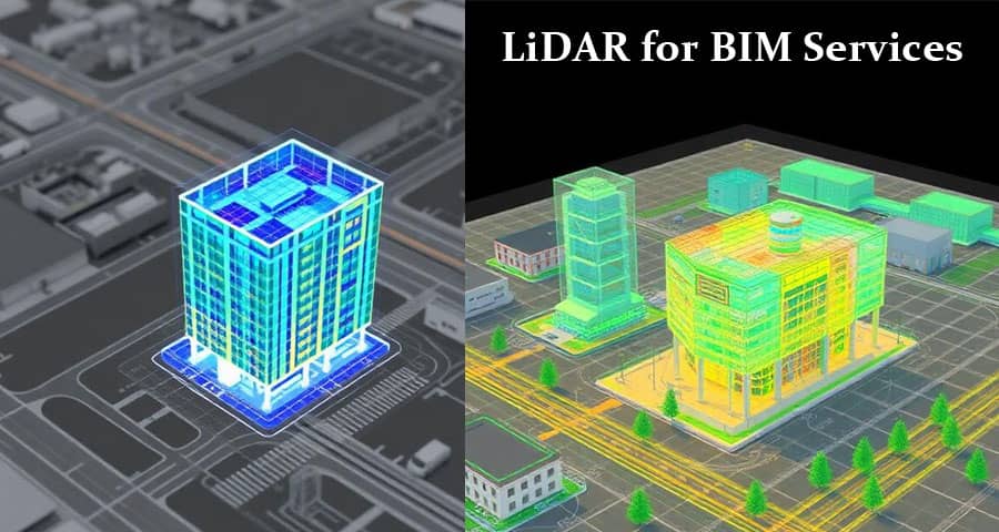
The Architecture, Engineering, and Construction (AEC) industry is undergoing a digital transformation, and LiDAR for Building Information Modelling (BIM) Services has emerged as one of the most powerful technologies driving this evolution. LiDAR, which stands for Light Detection and Ranging, provides highly accurate spatial data that enables the creation of intelligent BIM models for existing buildings, infrastructure projects, industrial facilities, and complex construction environments.
By integrating LiDAR scanning technology with BIM workflows, we can capture precise measurements, generate detailed 3D representations, and streamline project planning, design, renovation, and facility management processes. This combination delivers unparalleled accuracy, reduces project risks, minimizes rework, and significantly improves project outcomes.
What is LiDAR Technology?
LiDAR is a remote sensing technology that uses laser pulses to measure distances between the scanner and surrounding objects. These measurements generate millions of data points known as a point cloud, which accurately represents the physical environment.
The technology works by emitting laser beams that reflect off surfaces and return to the sensor. The scanner records the time taken for the laser pulse to return and calculates the exact location of each point in three-dimensional space.
The result is an extremely detailed digital representation of buildings, structures, landscapes, and infrastructure assets. This data forms the foundation for developing accurate BIM models used throughout the project lifecycle.
Understanding Building Information Modelling (BIM)
Building Information Modelling is a digital process that involves creating and managing detailed information about a built asset. BIM models contain both geometric and non-geometric data, allowing stakeholders to collaborate effectively across design, construction, and operations phases.
A BIM model serves as a centralized source of information that includes:
- Architectural elements
- Structural components
- Mechanical systems
- Electrical networks
- Plumbing systems
- Material specifications
- Asset information
- Facility management data
When LiDAR-generated point cloud data is integrated into BIM workflows, the resulting models reflect real-world conditions with exceptional accuracy.
The Importance of LiDAR for BIM Services
Traditional surveying methods often require extensive fieldwork, manual measurements, and repeated site visits. These approaches can be time-consuming, expensive, and prone to errors.
LiDAR for BIM services addresses these challenges by providing:
High-Accuracy Data Collection
LiDAR scanners capture millions of measurements within minutes, ensuring comprehensive and highly accurate site documentation. This level of precision is essential for renovation, retrofit, and expansion projects.
Reduced Project Risks
Accurate existing-condition models help identify clashes, structural constraints, and design conflicts early in the project lifecycle, minimizing costly surprises during construction.
Improved Collaboration
BIM models generated from LiDAR data create a shared digital environment where architects, engineers, contractors, and owners can collaborate efficiently.
Faster Project Delivery
Automated data capture and model creation reduce survey times and accelerate design and construction processes.
Enhanced Decision-Making
Project stakeholders gain access to reliable information, enabling informed decisions throughout planning, design, construction, and facility operations.
LiDAR Scan to BIM Process
The Scan to BIM workflow transforms physical environments into intelligent digital models through a systematic process.
1. Site Scanning
Professional survey teams deploy terrestrial laser scanners to capture the physical environment. Multiple scan positions are used to ensure complete coverage of the project site.
2. Point Cloud Registration
Individual scans are aligned and combined to create a unified point cloud dataset. This process ensures spatial accuracy across the entire project area.
3. Data Processing
The collected point cloud data is cleaned, filtered, and optimized to remove noise and unnecessary information.
4. BIM Model Development
Experienced BIM professionals convert the processed point cloud into intelligent BIM models using industry-leading software platforms.
5. Quality Assurance
Rigorous quality control procedures verify model accuracy, completeness, and compliance with project requirements.
6. Model Delivery
The final BIM model is delivered in the required formats, enabling seamless integration into design, construction, and facility management workflows.
Applications of LiDAR for BIM Services
Existing Building Documentation
LiDAR scanning accurately captures existing structures, creating detailed BIM models for renovation and refurbishment projects.
Historic Building Preservation
Historic structures require precise documentation to preserve architectural details. LiDAR technology records intricate features with exceptional accuracy, supporting restoration and conservation efforts.
Industrial Facility Modelling
Manufacturing plants, processing facilities, and industrial complexes often contain complex systems that are difficult to document manually. LiDAR enables efficient capture of these environments for BIM development.
Infrastructure Projects
Roads, bridges, tunnels, railways, and utility networks benefit significantly from LiDAR-based BIM services, providing accurate digital representations for planning and maintenance.
Construction Progress Monitoring
Periodic LiDAR scans allow project teams to compare actual construction progress against design models, improving project tracking and quality control.
Facility Management
Building owners and facility managers use LiDAR-generated BIM models to maintain accurate asset records and support operational decision-making.
Advantages of LiDAR-Based BIM Models
Exceptional Accuracy
LiDAR technology can achieve millimeter-level accuracy, making it ideal for projects where precision is critical.
Comprehensive Data Capture
Unlike traditional surveys, LiDAR records complete environments, ensuring no important details are overlooked.
Time Efficiency
Large facilities and complex sites can be scanned in a fraction of the time required by conventional measurement techniques.
Cost Savings
Accurate BIM models reduce design errors, construction rework, and project delays, resulting in substantial cost savings.
Improved Safety
Remote scanning minimizes the need for personnel to access hazardous or difficult-to-reach areas.
Future-Proof Documentation
The collected point cloud data serves as a permanent digital record that can be referenced for future projects and facility modifications.
Industries Benefiting from LiDAR for BIM Services
Commercial Construction
Office buildings, retail centers, hotels, and mixed-use developments rely on LiDAR-generated BIM models for efficient project execution.
Healthcare Facilities
Hospitals and medical centers require accurate documentation to support renovations while maintaining operational continuity.
Educational Institutions
Universities and schools utilize BIM models to manage campus facilities and plan future expansions.
Industrial and Manufacturing
Complex industrial facilities benefit from accurate digital twins that improve maintenance and operational planning.
Government and Public Infrastructure
Public agencies use LiDAR and BIM technologies for infrastructure development, asset management, and urban planning.
Residential Development
Residential projects leverage LiDAR-based BIM services to improve design accuracy and construction coordination.

Key Deliverables in LiDAR BIM Services
Professional LiDAR for BIM services typically include:
- Registered point cloud files
- Architectural BIM models
- Structural BIM models
- MEP BIM models
- As-built documentation
- Floor plans
- Elevations
- Sections
- Clash detection reports
- Asset information models
- Digital twin solutions
These deliverables support a wide range of project requirements across design, construction, and operations.
Future of LiDAR and BIM Integration
The future of the AEC industry lies in the continued integration of advanced digital technologies. LiDAR, BIM, Artificial Intelligence, Digital Twins, and Cloud Collaboration platforms are creating new opportunities for project efficiency and innovation.
As scanning hardware becomes more powerful and software capabilities continue to evolve, LiDAR for BIM services will play an increasingly important role in delivering smarter, more sustainable, and more efficient built environments.
Organizations that embrace these technologies gain a significant competitive advantage through improved accuracy, faster project delivery, enhanced collaboration, and better lifecycle asset management.
Why Choose Professional LiDAR for BIM Services
Successful Scan to BIM projects require expertise in surveying, point cloud processing, BIM modelling, and quality management. Professional service providers combine advanced technology with industry knowledge to deliver accurate, reliable, and project-ready BIM models.
From existing-condition documentation to large-scale infrastructure projects, LiDAR for BIM services provides the foundation for informed decision-making and successful project execution. By leveraging precise spatial data and intelligent BIM workflows, organizations can improve efficiency, reduce costs, and maximize the value of their built assets throughout the entire lifecycle.
Conclusion
LiDAR for Building Information Modelling Services represents a transformative solution for capturing, managing, and utilizing built environment data. Through highly accurate laser scanning, comprehensive point cloud generation, and intelligent BIM model development, organizations gain the insights needed to optimize planning, design, construction, and facility management.
As the demand for digital construction solutions continues to grow, LiDAR-enabled BIM services remain at the forefront of innovation, helping project teams achieve greater accuracy, collaboration, and long-term success in an increasingly data-driven construction industry.
Please view following short video for LiDAR for BIM Services
Also Read:
 All About Consider When Building a New Home | Important Factors to Consider When Building a New Home
All About M-Sand And River Sand: Complete Guide for Construction Professionals
Vacuum Concrete : Applicaton, Advantages and Disdvantages
Roof Ventilation: Types, Advantages and Disadvantages
Road Rollers: Types, Uses, Working Principles, and Advantages in Modern Construction